I’m trying to use the “coordinate mode” to set the locations of some Graffiti photo, but it does not work.
I try 2 format degrees and decimal:
29° 17’ 6,948" N, 81° 3’ 26,38" W
29.285,81.057
Anyone knows how to use this geolocation mode?
I have been able to get it to work ok using the following process.
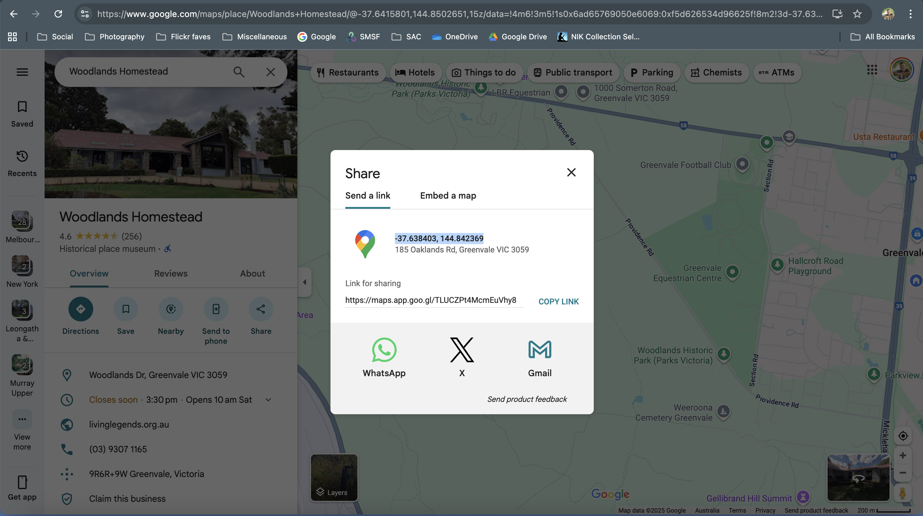
First I use Google Maps to get the co-ordinates location, and copy the location to the clipboard (it’s in the format -37.638403, 144.842369). See screenshot 1.
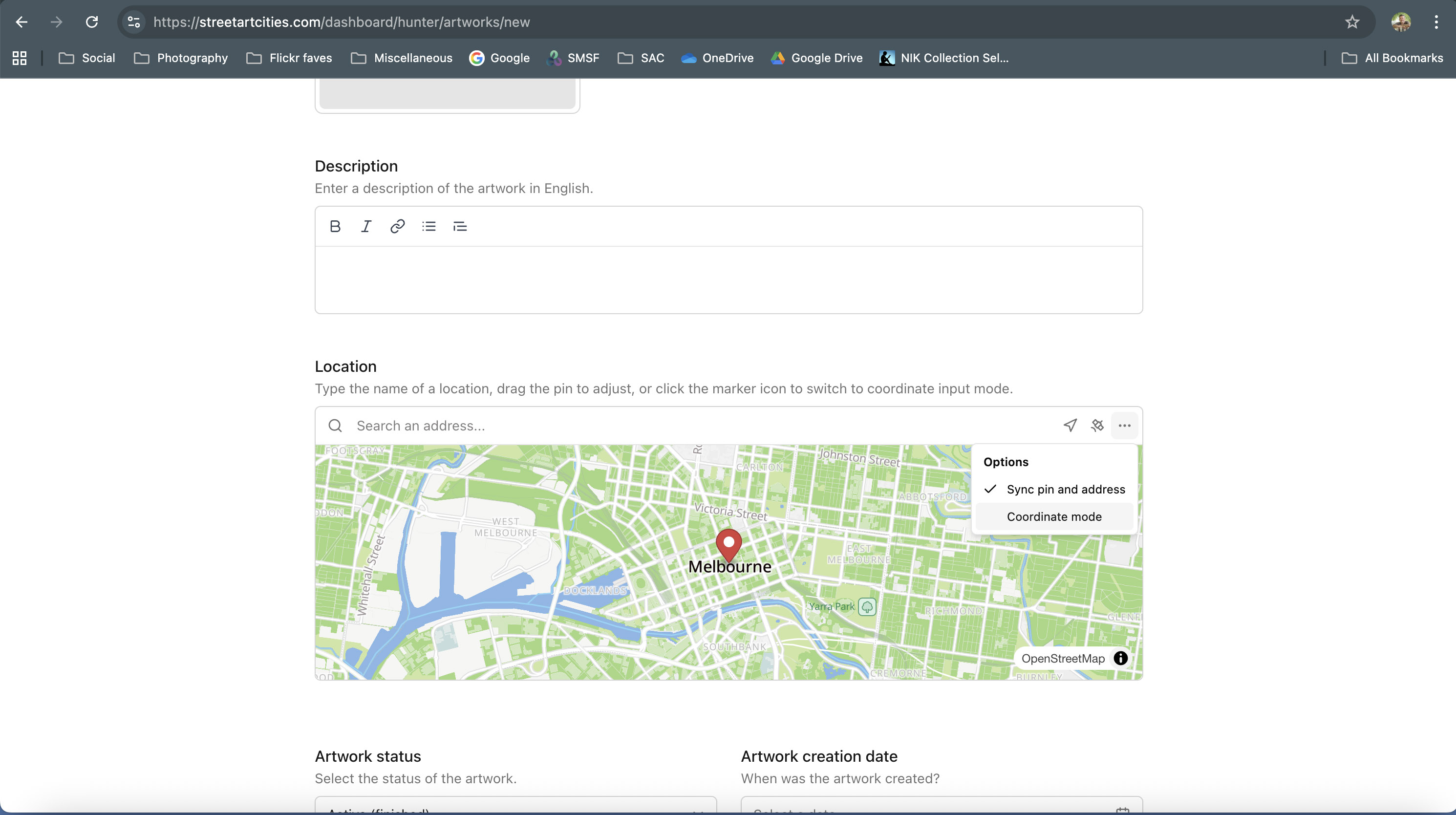
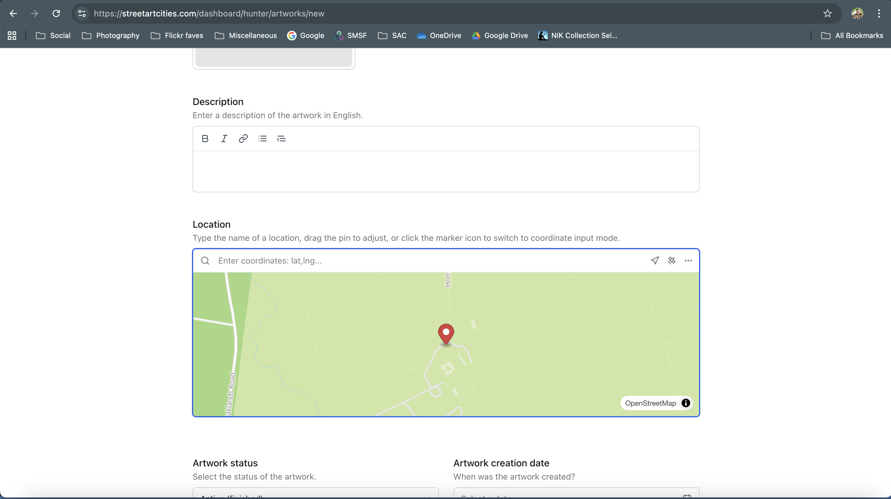
Then I use the map option menu and tick the “Coordinate mode” option. See screenshot 2.
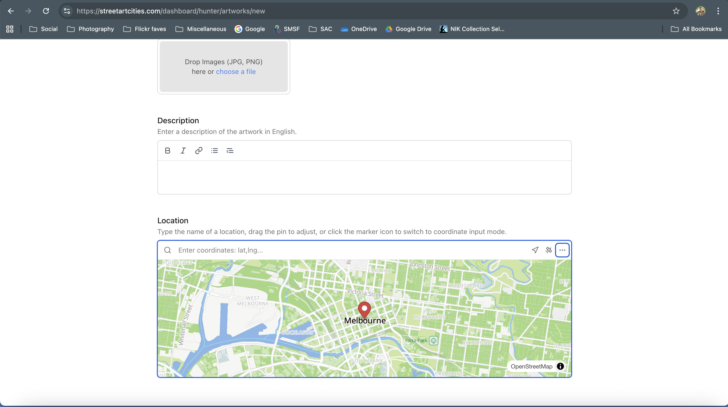
The map input field changes to show “Enter coordinates: lat, Ing…”. See screenshot 3.
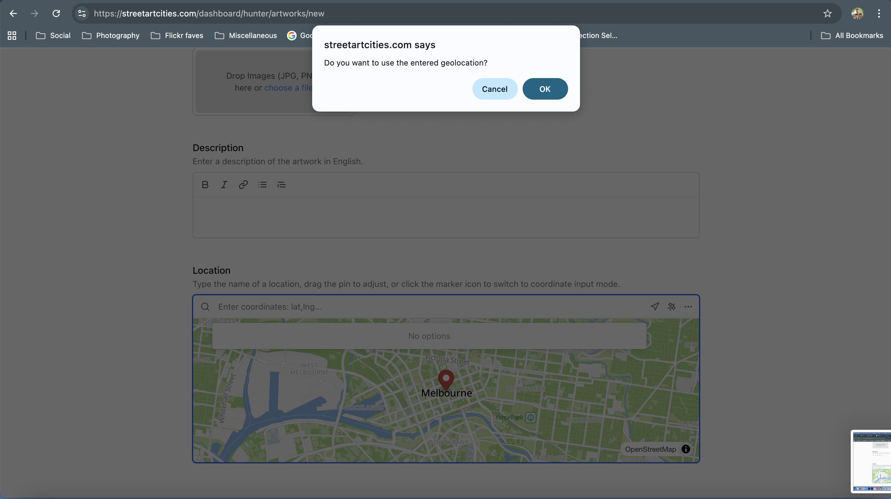
I click into this field and paste the coordinates from Google Maps, then press Enter. Street Art Cities responds with a dialog box. See screenshot 4.
Press ok on the dialog box and the map pin is moved to the correct position of the coordinates. Note the map input field still looks blank, but the map pin is in correct location. See screenshot 5.
Hey Lulo,
I just clicked on the link you provided in your other post (the one about the photos not loading properly), and I noticed that it looked like you might have used Coordinates mode for this post.
Can I ask why you decided to use coordinate mode for this one? I think in the case like this one where the mural is in a city it is probably better to use the normal address mode rather than coordinate mode.
Using coordinate mode doesn’t give the viewer an address so it might make it harder to find.
I have only used coordinate mode for pieces that are very much “off the beaten track”, like out in the country away from any major roads.
I use coordinates with some photos because in Daytona Beach the streets are sometimes like mazes, and it makes
difficult to find the exact place of the graffiti using only the name of the street/road/Blvd/etc.
It perhaps could be a good idea to allow to add photos with coordinates and also an additional label with the street name.
Sometimes moving the map pin can result in “unwanted” changes to the address, in this case you can turn off the “Sync pin and address” option in the map options menu.
Also to my opinion the best workflow: Drag the pin to the correct position.
Coordinations is a good option, but we need to bear mind that this is not the correct location, just an indication (since we photograph it from a distance, usual the opposite side of the building/wall.